See ![]() Mapping Discussion on the Wiki Spot hub for more discussion.
Mapping Discussion on the Wiki Spot hub for more discussion.
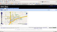
Preview of new map viewer:  Using OpenLayers
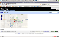
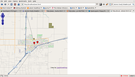
  Using OpenLayers and OpenStreetmap with Data
  Code used in a normal page doesn't have boxes around it's pngs
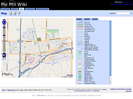
 Brent added CSS and a somewhat working legend
Mapping Development
Bugs with address macro
A number of bugs have been identified in the Address macro. See ![]() Ticket #59 for more information.
Ticket #59 for more information.
Bug resolved
Google Maps Alternatives
In the future, the ![]() OpenStreetMap project may provide another resource for map data.
OpenStreetMap project may provide another resource for map data.
Open Street Map already has a remote site embeddable map system: ![]() Slippy Map that should be well suited for our needs and it has the added benefit of being a wiki too so it seems like the right target, IMHO ;-)
Slippy Map that should be well suited for our needs and it has the added benefit of being a wiki too so it seems like the right target, IMHO ;-)
Open Layers Implementation
![]() OpenLayers a FOSS mapping API provides a good way for us to implement an open mapping scheme that can use widely available data sources like Google, Yahoo, Nasa, OpenStreetMap along side specific data sources obtained from city, county and university GIS departments.
OpenLayers a FOSS mapping API provides a good way for us to implement an open mapping scheme that can use widely available data sources like Google, Yahoo, Nasa, OpenStreetMap along side specific data sources obtained from city, county and university GIS departments.
A new branch in the source code was started to work on this
svn co http://svn.devjavu.com/sycamore/branches/mapping sycamore_map
Contact AlexMandel for more information or to help out.
So, of course, the "specific data sources" part of open layers is the best part. What's involved in us pulling the UCD / City GIS, for instance? Is it MapServer that powers the server end of things? Ideally we want to be able to run a Wiki Spot map server and bring in more data sources if possible...
-
For vector data, we would either need to convert shapefiles to GML or KML, or run Featureserver, Mapserver or Geoserver to produce a WFS. Featureserver is a small python app we could try to embed.
-
For raster data, we would need a WMS service, preferably tiled as in Tilecache. Also a small python app we could try to embed. Could also be done with a local instance of Mapserver or Geoserver, etc.
-
We could also build a tool based on python gis work being done with Plone at
![[WWW]](http://wikispot.org/wiki/eggheadbeta/img/sycamore-www.png) http://trac.gispython.org/
http://trac.gispython.org/
More to come on this topic later down the line.
Map Upgrade Code Sprint
December 2008 we plan to upgrade the mapping features of ![]() wikispot with a 2-day Coding sprint.
wikispot with a 2-day Coding sprint.
Date
-
December: Now, 2008
Schedule
-
Webbed due to lack of interest, but Alex has started anyways(see pic at the top)
-
Remote participants are still welcome, and ad hoc sessions could happen if you want to help.
Locations
If you think you have a location with good internet, proximity to food and room for 10 geeks let us know by listing it here.
Right now based on the low RSVP
-
Alex's house
Participants
Add yourself and role if you know it.
-
AlexMandel - Openlayers, OpenStreetmap and GIS
-
PhilipNeustrom - Wikispot Guru
-
BrentLaabs - is getting class credit for a GIS project, so he might as well do this one.
-
JoeWells - I can test things if you point me to an implementation running the new code, sorry I don't have time to compile/install/etc.
Plan
Done:
1. Create a new overview map of all data using OpenLayers & OpenStreetmap as the base.
2. Fix OpenStreetMap tiling which was giving me issues tonight, probably
because I didn't implement projections yet.
3a. Plot local data points on map with markers
3b. Pop-bubbles and link to their pages within the wiki.
To Do:
4. Deal with large datasets efficiently — We need to implement some type of clustering and resolution based
display to data to make it efficient.
5. Make it pretty - markers, legend, page text etc.
6. We should generate GeoRSS, Geojson and or kml from the database
6. Overhaul mini maps to use OSM as default
7. Edit admin interface to set starting map.
7. Allow for wiki admins to add other wms, wfs layers easily (Airphotos, example for Davis)
8. A search tool
9. category based thematic display
Todo List
-
Merge the Trunk into the mapping branch to bring it up to date - done.
-
Make new maps.
-
Create and admin interface or config file to add/enable various table layers
Code
-
Browse the code with comments and logs at the
![[WWW]](http://wikispot.org/wiki/eggheadbeta/img/sycamore-www.png) Github site
Github site
-
Checkout a copy of the mapping branch: git clone git://github.com/labster/sycamore.git


